
Scheduled Maintenance
This website will undergo scheduled maintenance on Tuesday, September 10th, between 11:00 and 15:00, as well as on Thursday, September 12th, between 10:00 and 12:00. During this time, services may be temporarily disrupted. We apologise for any inconvenience.
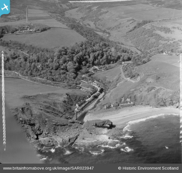
SAR023947 SCOTLAND (1955). General View Latheron, Caithness, Scotland. An oblique aerial photograph taken facing North/West. This image was marked by AeroPictorial Ltd for photo editing.
© Copyright OpenStreetMap contributors and licensed by the OpenStreetMap Foundation. 2024. Cartography is licensed as CC BY-SA.
Details
| Title | [SAR023947] General View Latheron, Caithness, Scotland. An oblique aerial photograph taken facing North/West. This image was marked by AeroPictorial Ltd for photo editing. |
| Reference | SAR023947 |
| Date | 1955 |
| Link | Canmore Collection item 1438432 |
| Place name | |
| Parish | LATHERON |
| District | CAITHNESS |
| Country | SCOTLAND |
| Easting / Northing | 311800, 922600 |
| Longitude / Latitude | -3.500064920724, 58.183718477512 |
| National Grid Reference | ND118226 |
Pins
 Phill |
Wednesday 6th of May 2015 12:32:16 PM |