
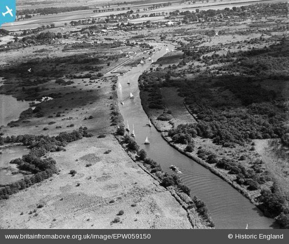
EPW059150 ENGLAND (1938). The River Bure at Broad Waters and Crabbett's Marsh, Woodbastwick, 1938
© Copyright OpenStreetMap contributors and licensed by the OpenStreetMap Foundation. 2026. Cartography is licensed as CC BY-SA.
Details
| Title | [EPW059150] The River Bure at Broad Waters and Crabbett's Marsh, Woodbastwick, 1938 |
| Reference | EPW059150 |
| Date | 3-September-1938 |
| Link | |
| Place name | WOODBASTWICK |
| Parish | WOODBASTWICK |
| District | |
| Country | ENGLAND |
| Easting / Northing | 633029, 317236 |
| Longitude / Latitude | 1.4495281097873, 52.702204610028 |
| National Grid Reference | TG330172 |
Pins
Be the first to add a comment to this image!