
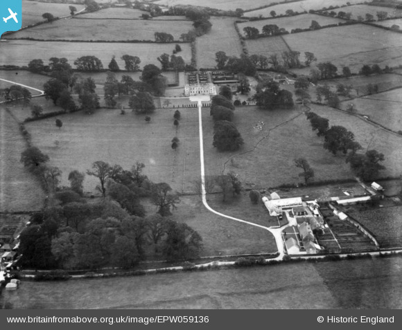
EPW059136 ENGLAND (1938). Kingston Russell House and Manor Farm, Long Bredy, 1938. This image has been produced from a print.
© Copyright OpenStreetMap contributors and licensed by the OpenStreetMap Foundation. 2026. Cartography is licensed as CC BY-SA.
Details
| Title | [EPW059136] Kingston Russell House and Manor Farm, Long Bredy, 1938. This image has been produced from a print. |
| Reference | EPW059136 |
| Date | 31-August-1938 |
| Link | |
| Place name | LONG BREDY |
| Parish | LONG BREDY |
| District | |
| Country | ENGLAND |
| Easting / Northing | 356974, 89660 |
| Longitude / Latitude | -2.6093688952271, 50.704409450321 |
| National Grid Reference | SY570897 |
Pins

Isleworth1961 |
Sunday 25th of February 2018 04:43:31 PM | |
|
Farm Buildings |
Wednesday 12th of November 2014 07:32:48 PM |