
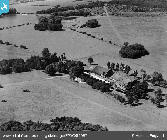
EPW059087 ENGLAND (1938). Foxburrows Farm, Hainault, 1938
© Copyright OpenStreetMap contributors and licensed by the OpenStreetMap Foundation. 2026. Cartography is licensed as CC BY-SA.
Nearby Images (2)
EPW059087

EPW059086

Details
| Title | [EPW059087] Foxburrows Farm, Hainault, 1938 |
| Reference | EPW059087 |
| Date | 2-September-1938 |
| Link | |
| Place name | HAINAULT |
| Parish | |
| District | |
| Country | ENGLAND |
| Easting / Northing | 547887, 192876 |
| Longitude / Latitude | 0.13623341508935, 51.614788321632 |
| National Grid Reference | TQ479929 |
Pins

brian |
Thursday 4th of December 2014 02:29:55 PM |