
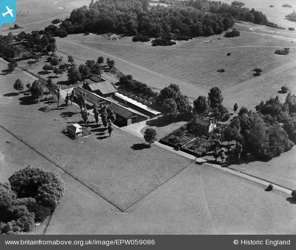
EPW059086 ENGLAND (1938). Foxburrows Farm, Hainault, 1938
© Copyright OpenStreetMap contributors and licensed by the OpenStreetMap Foundation. 2026. Cartography is licensed as CC BY-SA.
Nearby Images (2)
EPW059086

EPW059087

Details
| Title | [EPW059086] Foxburrows Farm, Hainault, 1938 |
| Reference | EPW059086 |
| Date | 2-September-1938 |
| Link | |
| Place name | HAINAULT |
| Parish | |
| District | |
| Country | ENGLAND |
| Easting / Northing | 547916, 192884 |
| Longitude / Latitude | 0.13665538458291, 51.614852589886 |
| National Grid Reference | TQ479929 |
Pins
Be the first to add a comment to this image!