
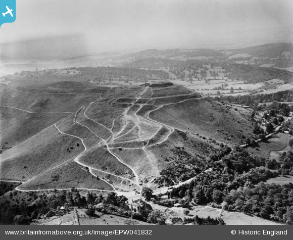
EPW041832 ENGLAND (1933). The Iron Age hillfort and medieval ringwork, Herefordshire Beacon, from the north-east, 1933. This image has been produced from a copy-negative.
© Copyright OpenStreetMap contributors and licensed by the OpenStreetMap Foundation. 2026. Cartography is licensed as CC BY-SA.
Details
| Title | [EPW041832] The Iron Age hillfort and medieval ringwork, Herefordshire Beacon, from the north-east, 1933. This image has been produced from a copy-negative. |
| Reference | EPW041832 |
| Date | June-1933 |
| Link | |
| Place name | HEREFORDSHIRE BEACON |
| Parish | COLWALL |
| District | |
| Country | ENGLAND |
| Easting / Northing | 376184, 240278 |
| Longitude / Latitude | -2.3474145421626, 52.059950540878 |
| National Grid Reference | SO762403 |
Pins
Be the first to add a comment to this image!