
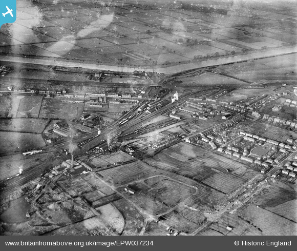
EPW037234 ENGLAND (1931). Saltney Railway Station and environs, Lache, 1931
© Copyright OpenStreetMap contributors and licensed by the OpenStreetMap Foundation. 2025. Cartography is licensed as CC BY-SA.
Details
| Title | [EPW037234] Saltney Railway Station and environs, Lache, 1931 |
| Reference | EPW037234 |
| Date | November-1931 |
| Link | |
| Place name | LACHE |
| Parish | |
| District | |
| Country | ENGLAND |
| Easting / Northing | 338632, 364941 |
| Longitude / Latitude | -2.9183087089608, 53.177742657264 |
| National Grid Reference | SJ386649 |
Pins
 Karlos |
Tuesday 31st of August 2021 01:17:01 AM | |
Mart Matt |
Tuesday 2nd of July 2013 01:09:21 PM | |
Pete65 |
Sunday 5th of May 2013 05:49:01 PM | |
Pete65 |
Sunday 5th of May 2013 05:46:45 PM | |
Pete65 |
Sunday 5th of May 2013 05:45:51 PM |
User Comment Contributions
No, I believe this is the site of the old Saltney brickworks. The stack in the photo was demolished by "Blaster Bates" possibly in the late 1960s. The short road led into St Marks road from the railway crossing in Boundary lane. The bottom left hand corner of the picture show what used to be the old claypit now filled in and built on. |
BarrieG |
Wednesday 1st of January 2014 02:49:41 PM |