
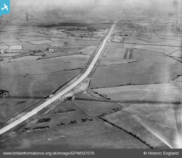
EPW037076 ENGLAND (1931). The East Lancashire Road (A580) crossing the Wigan Junction Dismantled Railway, Golborne, from the west, 1931
© Copyright OpenStreetMap contributors and licensed by the OpenStreetMap Foundation. 2025. Cartography is licensed as CC BY-SA.
Nearby Images (2)
EPW037076
 crossing the Wigan Junction Dismantled Railway, Golborne, from the west, 1931")
EPW037078
, Golborne, from the west, 1931")
Details
| Title | [EPW037076] The East Lancashire Road (A580) crossing the Wigan Junction Dismantled Railway, Golborne, from the west, 1931 |
| Reference | EPW037076 |
| Date | October-1931 |
| Link | |
| Place name | GOLBORNE |
| Parish | |
| District | |
| Country | ENGLAND |
| Easting / Northing | 363420, 396878 |
| Longitude / Latitude | -2.5510934268123, 53.467116064692 |
| National Grid Reference | SJ634969 |
Pins
 John W |
Saturday 7th of August 2021 05:52:23 PM | |
John W |
Saturday 7th of August 2021 05:35:28 PM |