
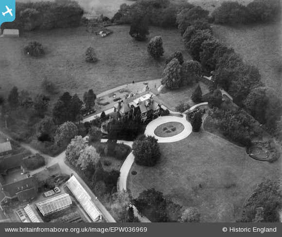
EPW036969 ENGLAND (1931). Longshaw, Chipstead, 1931
© Copyright OpenStreetMap contributors and licensed by the OpenStreetMap Foundation. 2025. Cartography is licensed as CC BY-SA.
Nearby Images (2)
EPW036969

EPW036968

Details
| Title | [EPW036969] Longshaw, Chipstead, 1931 |
| Reference | EPW036969 |
| Date | October-1931 |
| Link | |
| Place name | CHIPSTEAD |
| Parish | |
| District | |
| Country | ENGLAND |
| Easting / Northing | 527704, 157105 |
| Longitude / Latitude | -0.16805589290012, 51.298222479289 |
| National Grid Reference | TQ277571 |
Pins
Be the first to add a comment to this image!