
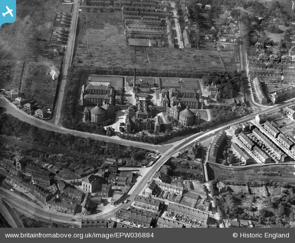
EPW036884 ENGLAND (1931). St Luke's Hospital, Halifax, 1931
© Copyright OpenStreetMap contributors and licensed by the OpenStreetMap Foundation. 2025. Cartography is licensed as CC BY-SA.
Nearby Images (2)
EPW036884

EPW036882

Details
| Title | [EPW036884] St Luke's Hospital, Halifax, 1931 |
| Reference | EPW036884 |
| Date | September-1931 |
| Link | |
| Place name | HALIFAX |
| Parish | |
| District | |
| Country | ENGLAND |
| Easting / Northing | 409617, 423192 |
| Longitude / Latitude | -1.8543010482665, 53.704843459006 |
| National Grid Reference | SE096232 |
Pins

Tonemart |
Saturday 21st of December 2013 04:09:21 PM | |
|
Tonemart |
Sunday 15th of December 2013 10:12:19 PM | |
|
Tonemart |
Sunday 15th of December 2013 10:05:17 PM | |
|
Tonemart |
Sunday 15th of December 2013 08:07:12 PM |
User Comment Contributions

The old Methodist Chapel and Chapel House in Chapel Lane, Salterhebble (2011) |
Tonemart |
Sunday 15th of December 2013 10:09:39 PM |