
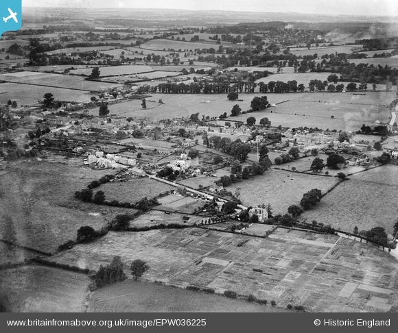
EPW036225 ENGLAND (1931). Station Road and environs, Thatcham, from the south-east, 1931
© Copyright OpenStreetMap contributors and licensed by the OpenStreetMap Foundation. 2025. Cartography is licensed as CC BY-SA.
Details
| Title | [EPW036225] Station Road and environs, Thatcham, from the south-east, 1931 |
| Reference | EPW036225 |
| Date | August-1931 |
| Link | |
| Place name | THATCHAM |
| Parish | THATCHAM |
| District | |
| Country | ENGLAND |
| Easting / Northing | 452129, 167041 |
| Longitude / Latitude | -1.2505697375301, 51.399508257372 |
| National Grid Reference | SU521670 |
Pins
 JNGREG |
Wednesday 7th of August 2019 10:15:51 PM | |
Gareth Lilly |
Monday 14th of December 2015 01:29:59 PM | |
smitty |
Monday 28th of April 2014 09:53:41 AM | |
smitty |
Monday 28th of April 2014 09:52:57 AM | |
smitty |
Monday 28th of April 2014 09:34:24 AM | |
smitty |
Monday 28th of April 2014 09:28:34 AM | |
smitty |
Monday 28th of April 2014 09:25:28 AM | |
 |
smitty |
Monday 28th of April 2014 09:17:20 AM |
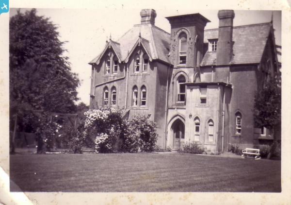
The house faced Station Rd and this is the rear view taken early to mid 50s. Trees are green apple. A red brick wall lined the street with a mailbox drop built into it to right of house. (next to the Vets Office that is now there (built in 59). |
smitty |
Monday 28th of April 2014 09:43:17 AM |