
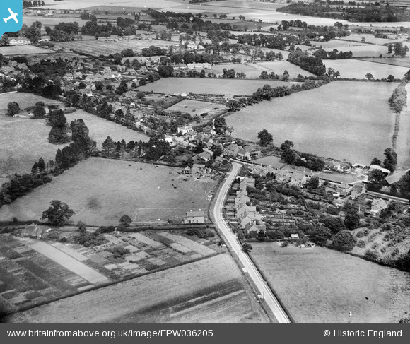
EPW036205 ENGLAND (1931). The junction of the Basingstoke Road and Beech Hill Road, Spencers Wood, from the south-west, 1931
© Copyright OpenStreetMap contributors and licensed by the OpenStreetMap Foundation. 2025. Cartography is licensed as CC BY-SA.
Nearby Images (2)
EPW036205

EPW036201

Details
| Title | [EPW036205] The junction of the Basingstoke Road and Beech Hill Road, Spencers Wood, from the south-west, 1931 |
| Reference | EPW036205 |
| Date | August-1931 |
| Link | |
| Place name | SPENCERS WOOD |
| Parish | SHINFIELD |
| District | |
| Country | ENGLAND |
| Easting / Northing | 471293, 166147 |
| Longitude / Latitude | -0.97527994492813, 51.389384785329 |
| National Grid Reference | SU713661 |
Pins

Charlie49 |
Friday 1st of April 2022 11:14:06 AM | |
|
Charlie49 |
Friday 1st of April 2022 11:13:29 AM | |
|
designking |
Saturday 13th of September 2014 09:56:35 PM |