
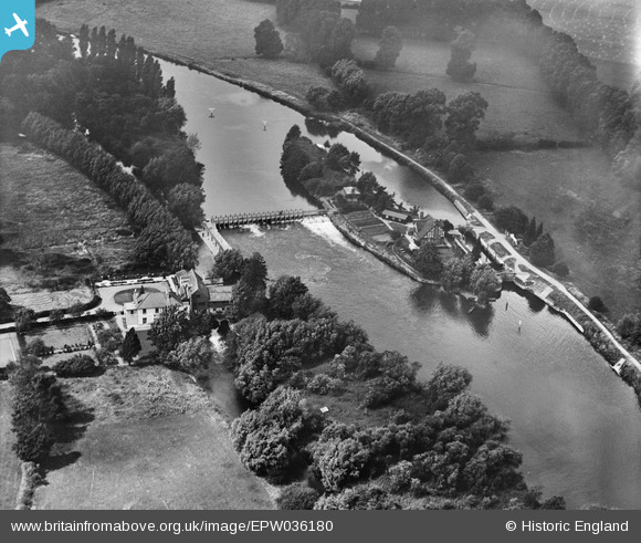
EPW036180 ENGLAND (1931). The weir and Bray Lock, Bray, 1931
© Copyright OpenStreetMap contributors and licensed by the OpenStreetMap Foundation. 2025. Cartography is licensed as CC BY-SA.
Nearby Images (6)
EPW036180

EPW005735

EPW005736

EAW017992

EAW017991

EPW037507

Details
| Title | [EPW036180] The weir and Bray Lock, Bray, 1931 |
| Reference | EPW036180 |
| Date | August-1931 |
| Link | |
| Place name | BRAY |
| Parish | BRAY |
| District | |
| Country | ENGLAND |
| Easting / Northing | 490946, 179725 |
| Longitude / Latitude | -0.68938006356968, 51.508644260669 |
| National Grid Reference | SU909797 |
Pins
Be the first to add a comment to this image!