
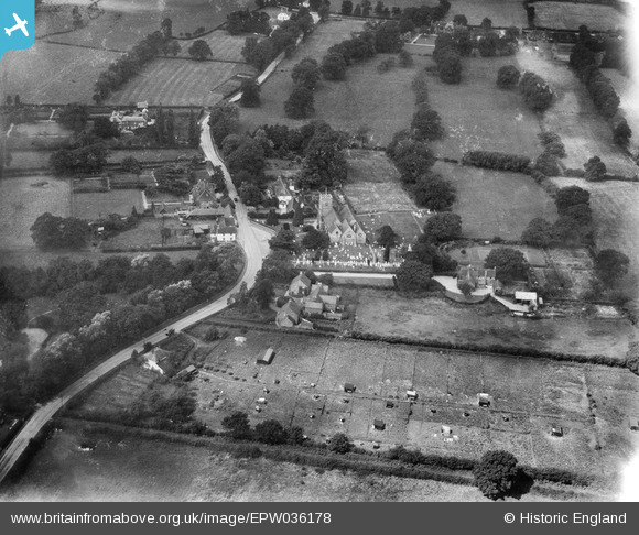
EPW036178 ENGLAND (1931). St Mary's Church and the village centre, Winkfield, 1931
© Copyright OpenStreetMap contributors and licensed by the OpenStreetMap Foundation. 2025. Cartography is licensed as CC BY-SA.
Nearby Images (2)
EPW036178

EPW036177

Details
| Title | [EPW036178] St Mary's Church and the village centre, Winkfield, 1931 |
| Reference | EPW036178 |
| Date | August-1931 |
| Link | |
| Place name | WINKFIELD |
| Parish | WINKFIELD |
| District | |
| Country | ENGLAND |
| Easting / Northing | 490438, 172421 |
| Longitude / Latitude | -0.69856907150316, 51.443061256603 |
| National Grid Reference | SU904724 |
Pins
Be the first to add a comment to this image!