
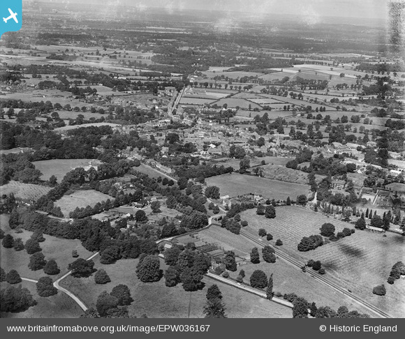
EPW036167 ENGLAND (1931). The town, Bracknell, from the south-east, 1931
© Copyright OpenStreetMap contributors and licensed by the OpenStreetMap Foundation. 2025. Cartography is licensed as CC BY-SA.
Details
| Title | [EPW036167] The town, Bracknell, from the south-east, 1931 |
| Reference | EPW036167 |
| Date | August-1931 |
| Link | |
| Place name | BRACKNELL |
| Parish | BRACKNELL |
| District | |
| Country | ENGLAND |
| Easting / Northing | 487503, 168773 |
| Longitude / Latitude | -0.74169475334315, 51.410725269971 |
| National Grid Reference | SU875688 |
Pins

Nemesis |
Tuesday 28th of July 2015 02:02:37 PM | |
|
Nemesis |
Tuesday 28th of July 2015 01:59:55 PM | |
|
Nemesis |
Tuesday 28th of July 2015 01:53:27 PM | |
|
Nemesis |
Tuesday 28th of July 2015 01:50:36 PM | |
|
Nemesis |
Tuesday 28th of July 2015 01:48:14 PM | |
|
Nemesis |
Tuesday 28th of July 2015 01:41:22 PM |