
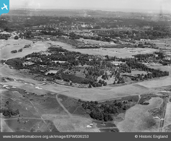
EPW036153 ENGLAND (1931). Titlarks Hill and Sunningdale Golf Course, Sunningdale, from the south, 1931
© Copyright OpenStreetMap contributors and licensed by the OpenStreetMap Foundation. 2025. Cartography is licensed as CC BY-SA.
Nearby Images (2)
EPW036153

EPW036150

Details
| Title | [EPW036153] Titlarks Hill and Sunningdale Golf Course, Sunningdale, from the south, 1931 |
| Reference | EPW036153 |
| Date | August-1931 |
| Link | |
| Place name | SUNNINGDALE |
| Parish | SUNNINGDALE |
| District | |
| Country | ENGLAND |
| Easting / Northing | 495770, 165765 |
| Longitude / Latitude | -0.62366134856755, 51.382346850811 |
| National Grid Reference | SU958658 |
Pins
Be the first to add a comment to this image!