
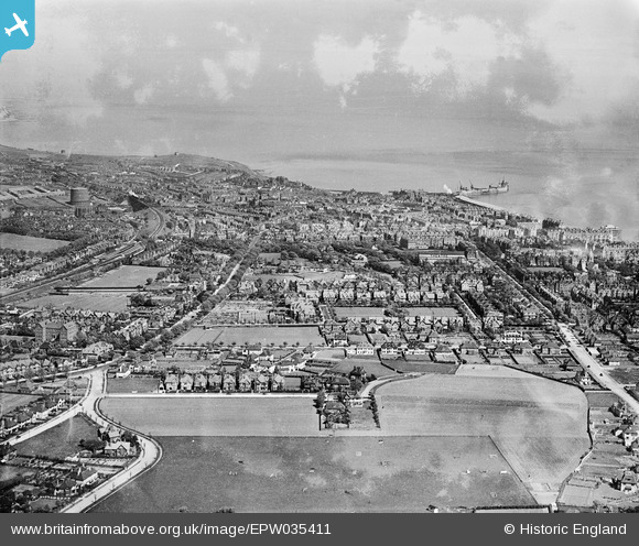
EPW035411 ENGLAND (1931). The town, Folkestone, from the west, 1931
© Copyright OpenStreetMap contributors and licensed by the OpenStreetMap Foundation. 2025. Cartography is licensed as CC BY-SA.
Details
| Title | [EPW035411] The town, Folkestone, from the west, 1931 |
| Reference | EPW035411 |
| Date | 25-May-1931 |
| Link | |
| Place name | FOLKESTONE |
| Parish | FOLKESTONE |
| District | |
| Country | ENGLAND |
| Easting / Northing | 621446, 135921 |
| Longitude / Latitude | 1.1618984410412, 51.079274028351 |
| National Grid Reference | TR214359 |
Pins

Sara |
Tuesday 30th of January 2024 07:44:27 PM | |
|
Sara |
Tuesday 30th of January 2024 07:41:59 PM | |
|
pmoss75369 |
Monday 29th of October 2018 01:26:27 PM | |
|
Paolo |
Tuesday 8th of January 2013 03:14:21 PM | |
|
Paolo |
Tuesday 8th of January 2013 03:11:34 PM | |
|
Chris_55 |
Sunday 6th of January 2013 05:35:53 PM |