
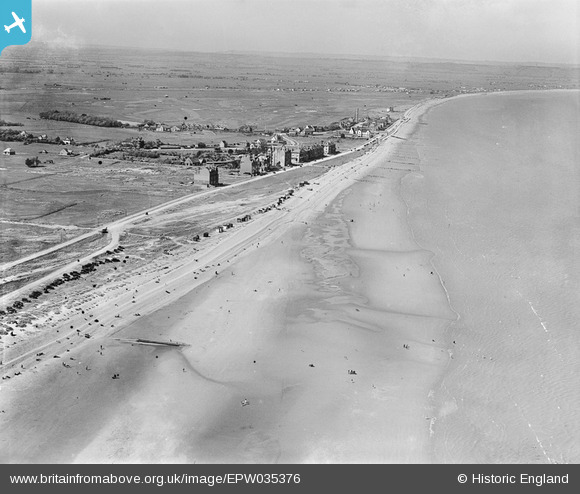
EPW035376 ENGLAND (1931). Romney Sands and the village, Littlestone-on-Sea, from the south-east, 1931
© Copyright OpenStreetMap contributors and licensed by the OpenStreetMap Foundation. 2025. Cartography is licensed as CC BY-SA.
Details
| Title | [EPW035376] Romney Sands and the village, Littlestone-on-Sea, from the south-east, 1931 |
| Reference | EPW035376 |
| Date | 25-May-1931 |
| Link | |
| Place name | LITTLESTONE-ON-SEA |
| Parish | NEW ROMNEY |
| District | |
| Country | ENGLAND |
| Easting / Northing | 608499, 123889 |
| Longitude / Latitude | 0.97038978531891, 50.97606442259 |
| National Grid Reference | TR085239 |
Pins

Bob Labrax |
Monday 16th of December 2024 02:21:55 PM | |
|
Bob Labrax |
Monday 16th of December 2024 02:20:08 PM | |
|
Bob Labrax |
Monday 16th of December 2024 02:19:08 PM | |
|
Bob Labrax |
Monday 16th of December 2024 02:18:27 PM |