
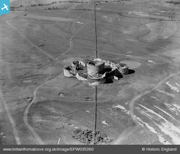
EPW035360 ENGLAND (1931). Camber Castle, Camber Castle, 1931
© Copyright OpenStreetMap contributors and licensed by the OpenStreetMap Foundation. 2025. Cartography is licensed as CC BY-SA.
Nearby Images (2)
EPW035360

EPW035361

Details
| Title | [EPW035360] Camber Castle, Camber Castle, 1931 |
| Reference | EPW035360 |
| Date | 25-May-1931 |
| Link | |
| Place name | CAMBER CASTLE |
| Parish | ICKLESHAM |
| District | |
| Country | ENGLAND |
| Easting / Northing | 592174, 118451 |
| Longitude / Latitude | 0.73523958793058, 50.932894309778 |
| National Grid Reference | TQ922185 |
Pins

totoro |
Tuesday 21st of January 2014 05:46:37 PM | |
|
totoro |
Tuesday 21st of January 2014 05:44:45 PM | |
|
totoro |
Tuesday 21st of January 2014 05:43:46 PM | |
|
totoro |
Tuesday 21st of January 2014 05:42:18 PM | |
|
totoro |
Tuesday 21st of January 2014 05:29:51 PM | |
|
totoro |
Tuesday 21st of January 2014 05:27:15 PM | |
|
totoro |
Tuesday 21st of January 2014 05:26:00 PM | |
|
totoro |
Tuesday 21st of January 2014 05:23:24 PM |
User Comment Contributions
Camber Castle. Icklesham Sea Road, Winchelsea / Icklesham, East Sussex TN36 4LL (Sometimes referred to as Winchelsea Castle) Please see the Factual Summary for history. |
totoro |
Tuesday 21st of January 2014 05:22:15 PM |