
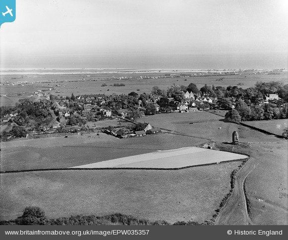
EPW035357 ENGLAND (1931). St Leonards Windmill and town, Winchelsea, from the north-west, 1931
© Copyright OpenStreetMap contributors and licensed by the OpenStreetMap Foundation. 2025. Cartography is licensed as CC BY-SA.
Details
| Title | [EPW035357] St Leonards Windmill and town, Winchelsea, from the north-west, 1931 |
| Reference | EPW035357 |
| Date | 25-May-1931 |
| Link | |
| Place name | WINCHELSEA |
| Parish | ICKLESHAM |
| District | |
| Country | ENGLAND |
| Easting / Northing | 590092, 117688 |
| Longitude / Latitude | 0.70524378736514, 50.926730015191 |
| National Grid Reference | TQ901177 |
Pins
Be the first to add a comment to this image!
User Comment Contributions
The mill, built in the 1820s or 1830s, blew down in the gale of 1987. |

WAS |
Monday 19th of August 2013 02:34:12 PM |