
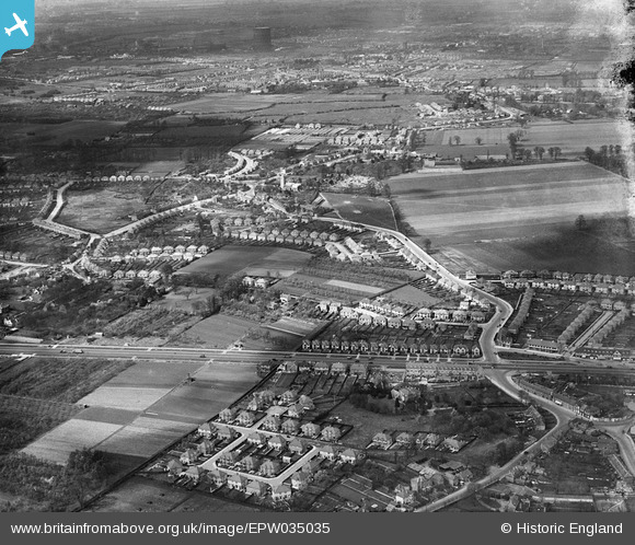
EPW035035 ENGLAND (1931). The Great West Road and new housing development around Hogarth Gardens and environs, Heston, from the south-east, 1931
© Copyright OpenStreetMap contributors and licensed by the OpenStreetMap Foundation. 2024. Cartography is licensed as CC BY-SA.
Nearby Images (5)
EPW035035

EPW057611

EPW038034A

EPR000683

EPW035022

Details
| Title | [EPW035035] The Great West Road and new housing development around Hogarth Gardens and environs, Heston, from the south-east, 1931 |
| Reference | EPW035035 |
| Date | April-1931 |
| Link | |
| Place name | HESTON |
| Parish | |
| District | |
| Country | ENGLAND |
| Easting / Northing | 513473, 176815 |
| Longitude / Latitude | -0.36580800719372, 51.478411342233 |
| National Grid Reference | TQ135768 |
Pins
 longshot |
Friday 27th of January 2023 02:26:31 AM | |
longshot |
Friday 27th of January 2023 02:23:01 AM | |
Isleworth1961 |
Saturday 22nd of July 2017 09:07:16 PM | |
Isleworth1961 |
Saturday 22nd of July 2017 09:06:35 PM | |
Isleworth1961 |
Saturday 22nd of July 2017 09:05:14 PM | |
Isleworth1961 |
Saturday 22nd of July 2017 09:04:27 PM | |
Isleworth1961 |
Saturday 22nd of July 2017 09:03:45 PM | |
Isleworth1961 |
Saturday 22nd of July 2017 09:03:01 PM | |
Isleworth1961 |
Saturday 22nd of July 2017 09:01:29 PM | |
Isleworth1961 |
Saturday 22nd of July 2017 09:00:20 PM | |
Isleworth1961 |
Saturday 22nd of July 2017 08:59:17 PM | |
Isleworth1961 |
Saturday 22nd of July 2017 08:58:17 PM | |
glennsalt@gmail.com |
Tuesday 1st of March 2016 12:58:39 PM | |
Bdog507 |
Tuesday 29th of December 2015 05:33:31 PM | |
 Class31 |
Thursday 23rd of July 2015 06:02:44 PM | |
Gez |
Thursday 9th of January 2014 10:55:18 PM |


