
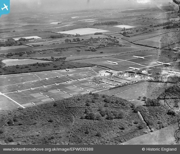
EPW032388 ENGLAND (1930). The Milborne Wood Poultry Farm and surrounding countryside, Milborne Wood, from the north-west, 1930
© Copyright OpenStreetMap contributors and licensed by the OpenStreetMap Foundation. 2025. Cartography is licensed as CC BY-SA.
Details
| Title | [EPW032388] The Milborne Wood Poultry Farm and surrounding countryside, Milborne Wood, from the north-west, 1930 |
| Reference | EPW032388 |
| Date | June-1930 |
| Link | |
| Place name | MILBORNE WOOD |
| Parish | DEWLISH |
| District | |
| Country | ENGLAND |
| Easting / Northing | 378441, 97019 |
| Longitude / Latitude | -2.3057735037853, 50.771785675122 |
| National Grid Reference | SY784970 |
Pins
Be the first to add a comment to this image!