
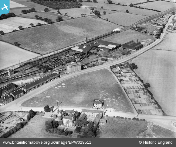
EPW029511 ENGLAND (1929). Rise Carr Rolling Mills, Darlington, 1929
© Copyright OpenStreetMap contributors and licensed by the OpenStreetMap Foundation. 2026. Cartography is licensed as CC BY-SA.
Details
| Title | [EPW029511] Rise Carr Rolling Mills, Darlington, 1929 |
| Reference | EPW029511 |
| Date | September-1929 |
| Link | |
| Place name | DARLINGTON |
| Parish | |
| District | |
| Country | ENGLAND |
| Easting / Northing | 428558, 516924 |
| Longitude / Latitude | -1.5584814498724, 54.546638512912 |
| National Grid Reference | NZ286169 |
Pins

1980-f |
Friday 23rd of August 2019 09:09:18 PM | |
|
1980-f |
Friday 23rd of August 2019 09:08:46 PM | |
|
1980-f |
Friday 23rd of August 2019 09:07:17 PM | |
|
MB |
Saturday 13th of April 2013 10:45:15 AM | |

Class31 |
Friday 12th of April 2013 06:56:14 PM | |
|
Class31 |
Friday 12th of April 2013 06:53:02 PM | |
|
Class31 |
Friday 12th of April 2013 06:51:26 PM | |
|
Class31 |
Friday 12th of April 2013 06:50:51 PM | |
|
Class31 |
Friday 12th of April 2013 06:49:49 PM |
User Comment Contributions
Rolling Mills gone - cleared site. Terrace houses gone. The allotments are a row of small industrial buildings. The triangle is full of buildings, mostly industrial, although the semi-detached cottages remain. The farm house remains, but the farm buildings are now houses. The field beyond the goods train shows the foundations of some sort of industrial activity that has arrived and gone in the intervening years. The ground at the bottom right hand corner is now the entrance to a new school. A lot of indications of cycles of change in this picture. |

Maurice |
Monday 15th of April 2013 08:22:02 AM |