
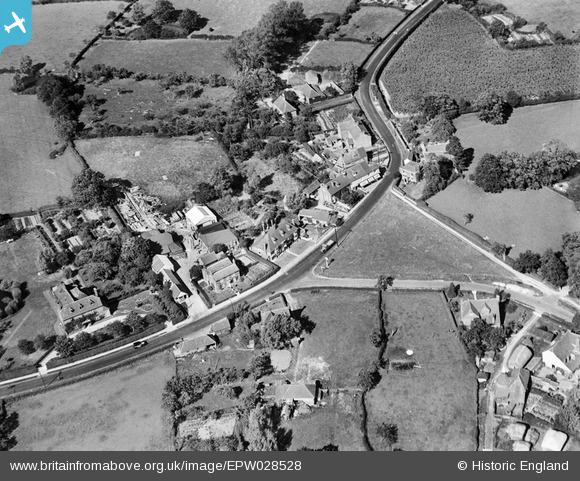
EPW028528 ENGLAND (1929). Chequers Inn and the village, High Halden, 1929
© Copyright OpenStreetMap contributors and licensed by the OpenStreetMap Foundation. 2025. Cartography is licensed as CC BY-SA.
Nearby Images (5)
EPW028528

EPW028526

EPW028525

EPW028527

EPW028524

Details
| Title | [EPW028528] Chequers Inn and the village, High Halden, 1929 |
| Reference | EPW028528 |
| Date | 30-August-1929 |
| Link | |
| Place name | HIGH HALDEN |
| Parish | HIGH HALDEN |
| District | |
| Country | ENGLAND |
| Easting / Northing | 590030, 137344 |
| Longitude / Latitude | 0.71465996827105, 51.103324006246 |
| National Grid Reference | TQ900373 |
Pins
Be the first to add a comment to this image!