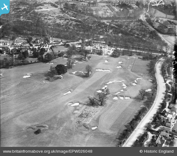
EPW026048 ENGLAND (1929). The Camden Park Golf Course and Camden Place Club House, Chislehurst, 1929
© Copyright OpenStreetMap contributors and licensed by the OpenStreetMap Foundation. 2025. Cartography is licensed as CC BY-SA.
Details
| Title | [EPW026048] The Camden Park Golf Course and Camden Place Club House, Chislehurst, 1929 |
| Reference | EPW026048 |
| Date | 18-April-1929 |
| Link | |
| Place name | CHISLEHURST |
| Parish | |
| District | |
| Country | ENGLAND |
| Easting / Northing | 543624, 170072 |
| Longitude / Latitude | 0.065405859481665, 51.410961579208 |
| National Grid Reference | TQ436701 |
Pins
 Gone2Kent |
Wednesday 1st of January 2014 02:44:43 PM |