
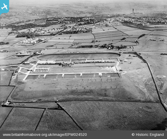
EPW024520 ENGLAND (1928). The Chellow Heights Reservoir and Filtration Works, Chellow Heights, 1928
© Copyright OpenStreetMap contributors and licensed by the OpenStreetMap Foundation. 2025. Cartography is licensed as CC BY-SA.
Details
| Title | [EPW024520] The Chellow Heights Reservoir and Filtration Works, Chellow Heights, 1928 |
| Reference | EPW024520 |
| Date | September-1928 |
| Link | |
| Place name | CHELLOW HEIGHTS |
| Parish | |
| District | |
| Country | ENGLAND |
| Easting / Northing | 411527, 435273 |
| Longitude / Latitude | -1.8249133042336, 53.813401242311 |
| National Grid Reference | SE115353 |
Pins

larkrise2 |
Saturday 25th of August 2012 02:28:14 PM | |
|
larkrise2 |
Saturday 25th of August 2012 02:04:33 PM | |
|
larkrise2 |
Saturday 25th of August 2012 02:03:19 PM | |
|
larkrise2 |
Saturday 25th of August 2012 02:02:46 PM | |
|
larkrise2 |
Saturday 25th of August 2012 02:02:02 PM | |
|
larkrise2 |
Saturday 25th of August 2012 02:00:44 PM | |
|
larkrise2 |
Saturday 25th of August 2012 01:59:58 PM | |
|
PJ Wright |
Monday 9th of July 2012 07:16:05 PM |