
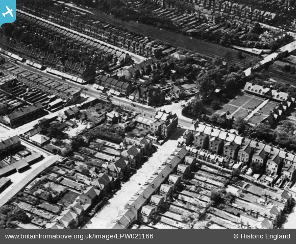
EPW021166 ENGLAND (1928). The junction of Fox Lane and Green Lanes, Palmers Green, 1928. This image has been produced from a print.
© Copyright OpenStreetMap contributors and licensed by the OpenStreetMap Foundation. 2026. Cartography is licensed as CC BY-SA.
Details
| Title | [EPW021166] The junction of Fox Lane and Green Lanes, Palmers Green, 1928. This image has been produced from a print. |
| Reference | EPW021166 |
| Date | April-1928 |
| Link | |
| Place name | PALMERS GREEN |
| Parish | |
| District | |
| Country | ENGLAND |
| Easting / Northing | 531196, 193000 |
| Longitude / Latitude | -0.10467120109382, 51.620041126768 |
| National Grid Reference | TQ312930 |
Pins

Mike |
Sunday 30th of July 2023 09:40:48 PM | |

downloader141 |
Tuesday 10th of November 2015 01:30:45 AM | |
|
downloader141 |
Tuesday 10th of November 2015 01:03:57 AM | |
|
downloader141 |
Monday 17th of August 2015 02:29:00 AM | |
|
downloader141 |
Monday 17th of August 2015 02:27:06 AM | |
|
downloader141 |
Monday 17th of August 2015 02:24:06 AM | |
|
John Wass |
Monday 8th of June 2015 03:26:37 PM |
