
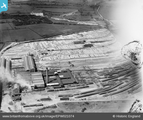
EPW021074 ENGLAND (1928). Stanton Iron Works, Stanton-by-Dale, 1928
© Copyright OpenStreetMap contributors and licensed by the OpenStreetMap Foundation. 2026. Cartography is licensed as CC BY-SA.
Nearby Images (2)
EPW021074

EPW012568

Details
| Title | [EPW021074] Stanton Iron Works, Stanton-by-Dale, 1928 |
| Reference | EPW021074 |
| Date | April-1928 |
| Link | |
| Place name | STANTON-BY-DALE |
| Parish | STANTON BY DALE |
| District | |
| Country | ENGLAND |
| Easting / Northing | 446765, 338686 |
| Longitude / Latitude | -1.3040039904358, 52.94320836835 |
| National Grid Reference | SK468387 |
Pins
 |

phillrooney |
Sunday 25th of November 2012 09:16:08 AM |
|
phillrooney |
Sunday 25th of November 2012 09:08:20 AM | |
|
phillrooney |
Sunday 25th of November 2012 09:07:33 AM | |
|
phillrooney |
Sunday 25th of November 2012 09:06:37 AM | |
|
phillrooney |
Sunday 25th of November 2012 09:06:00 AM | |
|
phillrooney |
Sunday 25th of November 2012 08:53:25 AM | |
|
MB |
Tuesday 16th of October 2012 03:51:07 PM |
User Comment Contributions
Stantom Iron Works and concrete plant were established on a greenfield site at some time after 1914 |
MB |
Tuesday 16th of October 2012 03:49:50 PM |
See the large number of concrete pipes stored on site in the centre of the image from the new spun-pipe plant. If it helps, Twelvehouses is in the top right, with the road to Stanton by Dale crossing the centre. |
Ilsonbloke |
Saturday 14th of July 2012 09:50:58 AM |