
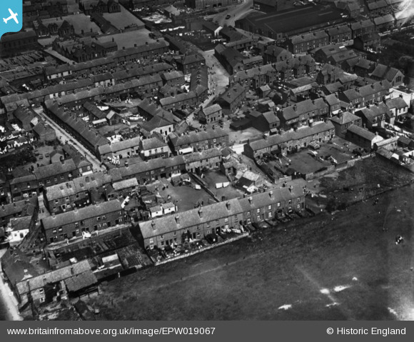
EPW019067 ENGLAND (1927). Thanet Street and Grundy Road, Clay Cross, 1927. This image has been produced from a print.
© Copyright OpenStreetMap contributors and licensed by the OpenStreetMap Foundation. 2026. Cartography is licensed as CC BY-SA.
Nearby Images (2)
EPW019067

EPW019072

Details
| Title | [EPW019067] Thanet Street and Grundy Road, Clay Cross, 1927. This image has been produced from a print. |
| Reference | EPW019067 |
| Date | 4-August-1927 |
| Link | |
| Place name | CLAY CROSS |
| Parish | CLAY CROSS |
| District | |
| Country | ENGLAND |
| Easting / Northing | 439270, 363083 |
| Longitude / Latitude | -1.4125688071889, 53.163130109739 |
| National Grid Reference | SK393631 |
Pins

John Wass |
Tuesday 8th of November 2016 02:25:12 PM | |
|
Pete L |
Wednesday 24th of June 2015 09:51:50 PM | |
|
Pete L |
Wednesday 24th of June 2015 09:40:44 PM | |
|
Pete L |
Wednesday 24th of June 2015 09:39:10 PM | |
|
Pete L |
Wednesday 24th of June 2015 09:38:08 PM | |
|
Pete L |
Wednesday 12th of November 2014 08:32:00 PM | |
|
Pete L |
Wednesday 12th of November 2014 02:19:17 PM | |
|
Pete L |
Wednesday 12th of November 2014 02:18:25 PM |