
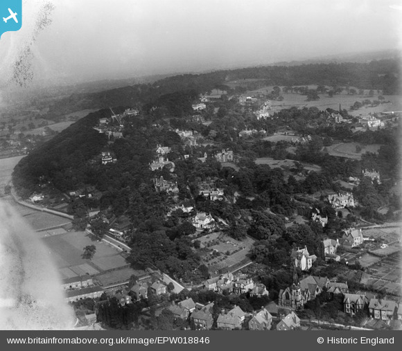
EPW018846 ENGLAND (1927). Woodbrook Road and environs, Alderley Edge, from the north-west, 1927
© Copyright OpenStreetMap contributors and licensed by the OpenStreetMap Foundation. 2025. Cartography is licensed as CC BY-SA.
Nearby Images (2)
EPW018846

EPW017611

Details
| Title | [EPW018846] Woodbrook Road and environs, Alderley Edge, from the north-west, 1927 |
| Reference | EPW018846 |
| Date | 10-July-1927 |
| Link | |
| Place name | ALDERLEY EDGE |
| Parish | ALDERLEY EDGE |
| District | |
| Country | ENGLAND |
| Easting / Northing | 384625, 378255 |
| Longitude / Latitude | -2.2307289520765, 53.300749670695 |
| National Grid Reference | SJ846783 |
Pins
Be the first to add a comment to this image!