
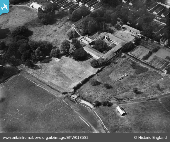
EPW018582 ENGLAND (1927). Stonar House, Sandwich, 1927
© Copyright OpenStreetMap contributors and licensed by the OpenStreetMap Foundation. 2026. Cartography is licensed as CC BY-SA.
Nearby Images (10)
EPW018582

EPW018590

EPW018583

EPW018585

EPW018587

EPW018581

EPW018584

EPW018589

EPW018588

EPW018586

Details
| Title | [EPW018582] Stonar House, Sandwich, 1927 |
| Reference | EPW018582 |
| Date | 22-June-1927 |
| Link | |
| Place name | SANDWICH |
| Parish | SANDWICH |
| District | |
| Country | ENGLAND |
| Easting / Northing | 633559, 158575 |
| Longitude / Latitude | 1.3492669740651, 51.27785268373 |
| National Grid Reference | TR336586 |
Pins
Be the first to add a comment to this image!