
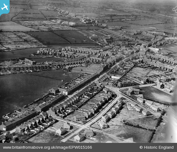
EPW015166 ENGLAND (1926). Belvoir Road and the Elastic Web Factory, Coalville, 1926
© Copyright OpenStreetMap contributors and licensed by the OpenStreetMap Foundation. 2025. Cartography is licensed as CC BY-SA.
Details
| Title | [EPW015166] Belvoir Road and the Elastic Web Factory, Coalville, 1926 |
| Reference | EPW015166 |
| Date | 13-May-1926 |
| Link | |
| Place name | COALVILLE |
| Parish | |
| District | |
| Country | ENGLAND |
| Easting / Northing | 442413, 313781 |
| Longitude / Latitude | -1.3720068782639, 52.719675805848 |
| National Grid Reference | SK424138 |
Pins
 |

Class31 |
Tuesday 5th of May 2015 08:36:55 AM |

MB |
Wednesday 26th of September 2012 02:23:22 PM | |
|
MB |
Wednesday 26th of September 2012 02:21:21 PM | |
|
MB |
Wednesday 26th of September 2012 02:20:43 PM | |
|
MB |
Wednesday 26th of September 2012 02:20:05 PM | |
|
MB |
Wednesday 26th of September 2012 02:17:12 PM |
User Comment Contributions
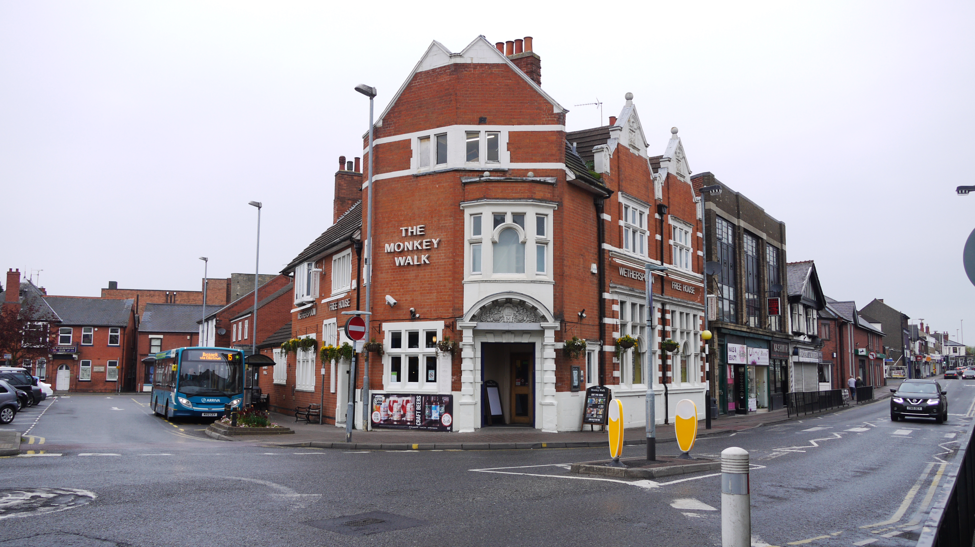
The Monkey Walk PH, Coalville, 02/05/2015 |
Class31 |
Tuesday 5th of May 2015 08:31:52 AM |
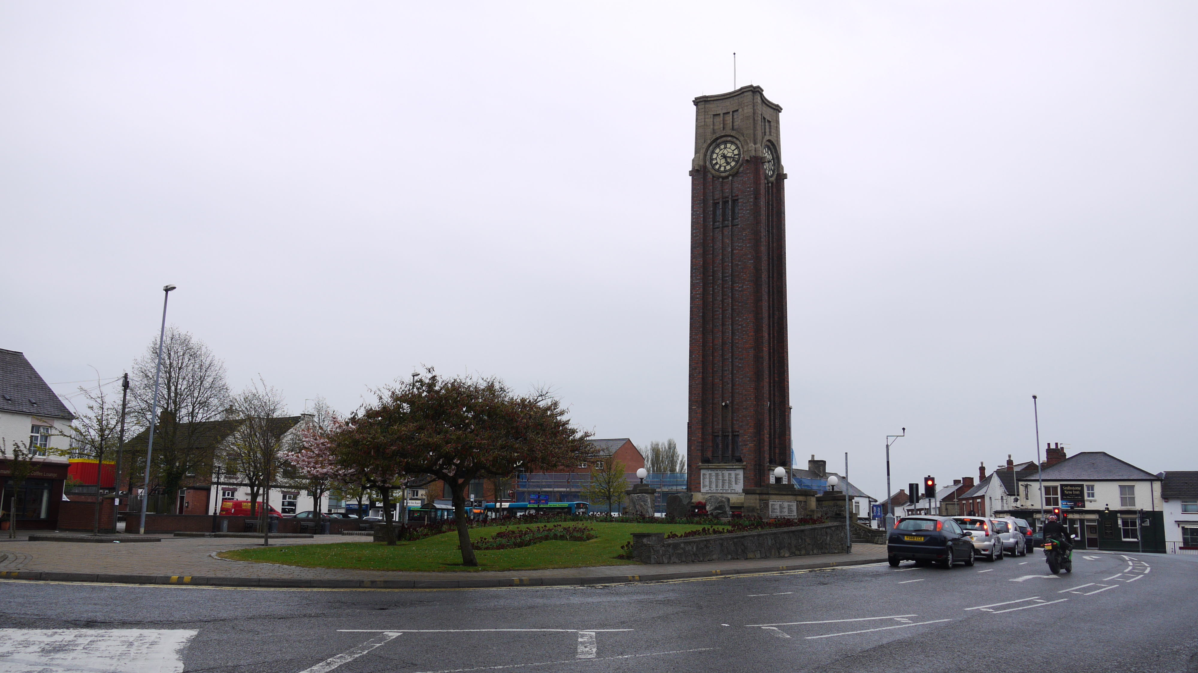
Memorial Square, Coalville, 02/05/2015 |
Class31 |
Tuesday 5th of May 2015 08:30:20 AM |
I believe the large factory in the centre of this image was actually Eatoughs Shoes and not the Clutsoms webbing factory which was on Highfield Street not Belvoir Road |
Timboishere |
Tuesday 26th of June 2012 09:02:06 PM |