
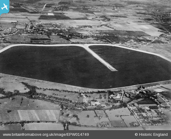
EPW014749 ENGLAND (1926). The Queen Mary Reservoir, Littleton, 1926. This image has been produced from a copy-negative.
© Copyright OpenStreetMap contributors and licensed by the OpenStreetMap Foundation. 2026. Cartography is licensed as CC BY-SA.
Details
| Title | [EPW014749] The Queen Mary Reservoir, Littleton, 1926. This image has been produced from a copy-negative. |
| Reference | EPW014749 |
| Date | 2-March-1926 |
| Link | |
| Place name | LITTLETON |
| Parish | |
| District | |
| Country | ENGLAND |
| Easting / Northing | 507171, 169658 |
| Longitude / Latitude | -0.45869849818819, 51.415304091121 |
| National Grid Reference | TQ072697 |
Pins

paul |
Tuesday 27th of June 2023 07:17:56 PM | |
|
paul |
Tuesday 27th of June 2023 07:15:11 PM | |
|
paul |
Tuesday 27th of June 2023 07:09:29 PM | |
|
paul |
Tuesday 27th of June 2023 07:07:48 PM | |
|
paul |
Tuesday 27th of June 2023 07:06:39 PM |