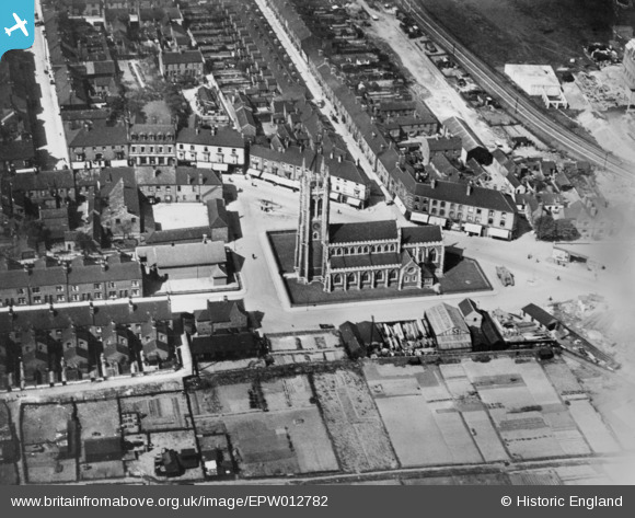
EPW012782 ENGLAND (1925). St John's Church, Scunthorpe, 1925. This image has been produced from a copy-negative.
© Copyright OpenStreetMap contributors and licensed by the OpenStreetMap Foundation. 2024. Cartography is licensed as CC BY-SA.
Details
| Title | [EPW012782] St John's Church, Scunthorpe, 1925. This image has been produced from a copy-negative. |
| Reference | EPW012782 |
| Date | 15-May-1925 |
| Link | |
| Place name | SCUNTHORPE |
| Parish | |
| District | |
| Country | ENGLAND |
| Easting / Northing | 489998, 411482 |
| Longitude / Latitude | -0.64011725226087, 53.591940679537 |
| National Grid Reference | SE900115 |
Pins
 AD |
Monday 18th of March 2024 04:20:22 PM |


![[EPW012782] St John's Church, Scunthorpe, 1925. This image has been produced from a copy-negative.](http://britainfromabove.org.uk/sites/all/libraries/aerofilms-images/public/100x100/EPW/012/EPW012782.jpg)
![[EPW012780] Market Hill and a fairground opposite the Blue Bell Hotel, Scunthorpe, 1925. This image has been produced from a copy-negative.](http://britainfromabove.org.uk/sites/all/libraries/aerofilms-images/public/100x100/EPW/012/EPW012780.jpg)