
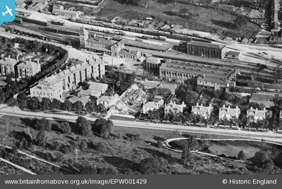
EPW001429 ENGLAND (1920). Tunbridge Wells West railway station and environs, Royal Tunbridge Wells, 1920. This image has been produced from a copy-negative.
© Copyright OpenStreetMap contributors and licensed by the OpenStreetMap Foundation. 2026. Cartography is licensed as CC BY-SA.
Details
| Title | [EPW001429] Tunbridge Wells West railway station and environs, Royal Tunbridge Wells, 1920. This image has been produced from a copy-negative. |
| Reference | EPW001429 |
| Date | 8-June-1920 |
| Link | |
| Place name | ROYAL TUNBRIDGE WELLS |
| Parish | |
| District | |
| Country | ENGLAND |
| Easting / Northing | 557800, 138505 |
| Longitude / Latitude | 0.25516950400774, 51.123537080971 |
| National Grid Reference | TQ578385 |
Pins

huw_griff |
Tuesday 6th of April 2021 12:54:22 PM |