
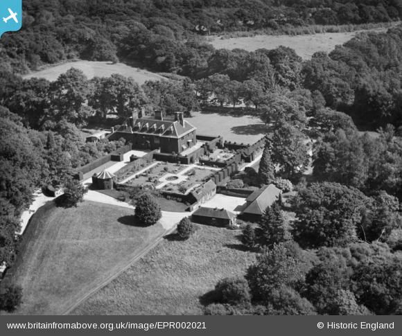
EPR002021 ENGLAND (1936). Heywood Manor (The Old Mansion), Boldre, 1936
© Copyright OpenStreetMap contributors and licensed by the OpenStreetMap Foundation. 2026. Cartography is licensed as CC BY-SA.
Details
| Title | [EPR002021] Heywood Manor (The Old Mansion), Boldre, 1936 |
| Reference | EPR002021 |
| Date | 24-August-1936 |
| Link | |
| Place name | BOLDRE |
| Parish | BOLDRE |
| District | |
| Country | ENGLAND |
| Easting / Northing | 432067, 99128 |
| Longitude / Latitude | -1.5450106257701, 50.790266720692 |
| National Grid Reference | SZ321991 |
Pins
Be the first to add a comment to this image!