
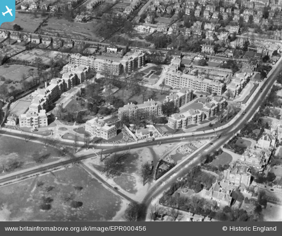
EPR000456 ENGLAND (1935). Manor Fields, Putney, 1935
© Copyright OpenStreetMap contributors and licensed by the OpenStreetMap Foundation. 2026. Cartography is licensed as CC BY-SA.
Nearby Images (2)
EPR000456

EPW045421

Details
| Title | [EPR000456] Manor Fields, Putney, 1935 |
| Reference | EPR000456 |
| Date | 21-March-1935 |
| Link | |
| Place name | PUTNEY |
| Parish | |
| District | |
| Country | ENGLAND |
| Easting / Northing | 523651, 174260 |
| Longitude / Latitude | -0.22019546562183, 51.453312849804 |
| National Grid Reference | TQ237743 |
Pins

Robin |
Tuesday 17th of March 2020 11:07:54 PM | |
|
SS10 |
Sunday 17th of July 2016 12:04:11 PM | |
I grew up across the road - at St Ronans. We were taught that the Green Man was the first change of horses, having come up Putney Hill, on the road to Portsmouth. |
Angus Cleaver |
Saturday 22nd of October 2016 02:49:20 PM |