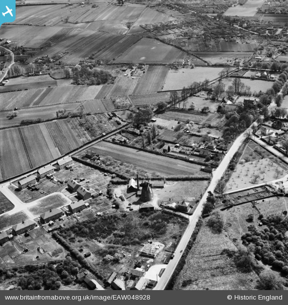
EAW048928 ENGLAND (1953). Tiptree Windmill and Church Road, Tiptree, 1953
© Copyright OpenStreetMap contributors and licensed by the OpenStreetMap Foundation. 2025. Cartography is licensed as CC BY-SA.
Details
| Title | [EAW048928] Tiptree Windmill and Church Road, Tiptree, 1953 |
| Reference | EAW048928 |
| Date | 2-May-1953 |
| Link | |
| Place name | TIPTREE |
| Parish | TIPTREE |
| District | |
| Country | ENGLAND |
| Easting / Northing | 589499, 216575 |
| Longitude / Latitude | 0.74954784786352, 51.815181708059 |
| National Grid Reference | TL895166 |


![[EAW048928] Tiptree Windmill and Church Road, Tiptree, 1953](http://britainfromabove.org.uk/sites/all/libraries/aerofilms-images/public/100x100/EAW/048/EAW048928.jpg)
![[EAW048927] Tiptree Windmill, Maypole Road and environs, Tiptree, 1953](http://britainfromabove.org.uk/sites/all/libraries/aerofilms-images/public/100x100/EAW/048/EAW048927.jpg)
