
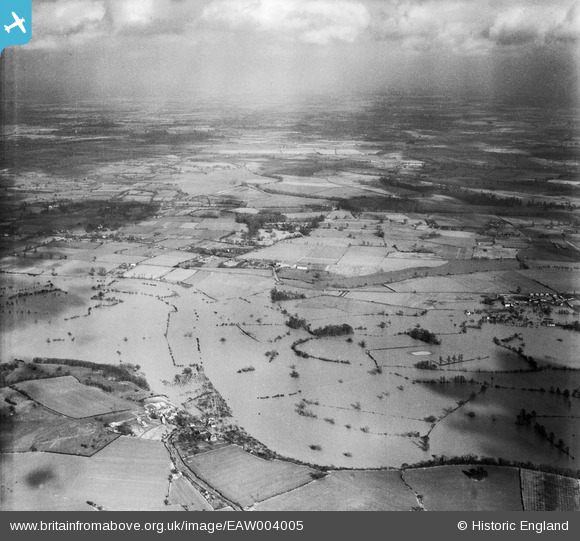
EAW004005 ENGLAND (1947). Flooding along the River Severn near Clevelode, Clifton, from the west, 1947
© Copyright OpenStreetMap contributors and licensed by the OpenStreetMap Foundation. 2026. Cartography is licensed as CC BY-SA.
Details
| Title | [EAW004005] Flooding along the River Severn near Clevelode, Clifton, from the west, 1947 |
| Reference | EAW004005 |
| Date | 21-March-1947 |
| Link | |
| Place name | CLIFTON |
| Parish | SEVERN STOKE |
| District | |
| Country | ENGLAND |
| Easting / Northing | 384109, 246902 |
| Longitude / Latitude | -2.2321191894278, 52.119794495052 |
| National Grid Reference | SO841469 |
Pins
Be the first to add a comment to this image!