
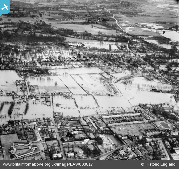
EAW003817 ENGLAND (1947). Flooding around Blackamoor Lane and environs, Maidenhead, 1947
© Copyright OpenStreetMap contributors and licensed by the OpenStreetMap Foundation. 2025. Cartography is licensed as CC BY-SA.
Details
| Title | [EAW003817] Flooding around Blackamoor Lane and environs, Maidenhead, 1947 |
| Reference | EAW003817 |
| Date | 19-March-1947 |
| Link | |
| Place name | MAIDENHEAD |
| Parish | |
| District | |
| Country | ENGLAND |
| Easting / Northing | 489550, 181785 |
| Longitude / Latitude | -0.70896866082649, 51.527387077807 |
| National Grid Reference | SU896818 |
Pins
Be the first to add a comment to this image!