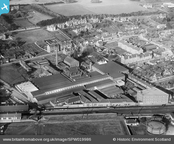
spw019986 SCOTLAND (1927). Monifieth, general view, showing works on High Street and Monifieth Station. An oblique aerial photograph taken facing east.
© Copyright OpenStreetMap contributors and licensed by the OpenStreetMap Foundation. 2024. Cartography is licensed as CC BY-SA.
Details
| Title | [SPW019986] Monifieth, general view, showing works on High Street and Monifieth Station. An oblique aerial photograph taken facing east. |
| Reference | SPW019986 |
| Date | 1927 |
| Link | Canmore Collection item 1246384 |
| Place name | |
| Parish | MONIFIETH (ANGUS) |
| District | CITY OF DUNDEE |
| Country | SCOTLAND |
| Easting / Northing | 349776, 732408 |
| Longitude / Latitude | -2.8155381212495, 56.481205037926 |
| National Grid Reference | NO498324 |
Pins
 Survey of London historian |
Wednesday 8th of July 2015 03:12:02 AM | |
 balbeggie |
Thursday 26th of March 2015 12:07:52 PM | |
 alex |
Sunday 8th of June 2014 08:34:52 PM | |
 Survey of London historian |
Tuesday 7th of August 2012 11:28:47 AM |
User Comment Contributions
User stumitch made this comment: "James F Low Foundry made Rob Roy Dumper Trucks among other things. Also made Munitions in the war." |
 Brian Wilkinson |
Tuesday 23rd of October 2012 11:16:43 AM |

