
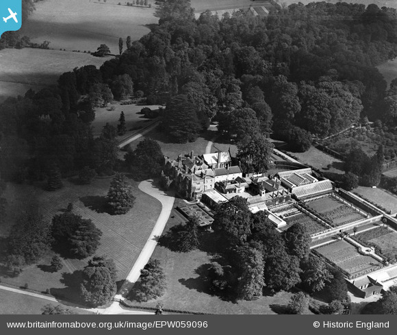
epw059096 ENGLAND (1938). Wall Hall, Aldenham, 1938
© Copyright OpenStreetMap contributors and licensed by the OpenStreetMap Foundation. 2024. Cartography is licensed as CC BY-SA.
Details
| Title | [EPW059096] Wall Hall, Aldenham, 1938 |
| Reference | EPW059096 |
| Date | 2-September-1938 |
| Link | |
| Place name | ALDENHAM |
| Parish | ALDENHAM |
| District | |
| Country | ENGLAND |
| Easting / Northing | 513705, 199509 |
| Longitude / Latitude | -0.35511828350714, 51.682354101861 |
| National Grid Reference | TQ137995 |
Pins
Be the first to add a comment to this image!