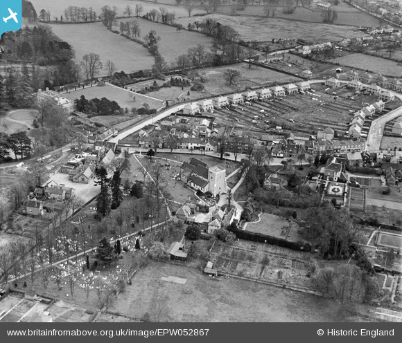
epw052867 ENGLAND (1937). St Lawrence's Church and environs, Abbots Langley, 1937
© Copyright OpenStreetMap contributors and licensed by the OpenStreetMap Foundation. 2024. Cartography is licensed as CC BY-SA.
Details
| Title | [EPW052867] St Lawrence's Church and environs, Abbots Langley, 1937 |
| Reference | EPW052867 |
| Date | 16-April-1937 |
| Link | |
| Place name | ABBOTS LANGLEY |
| Parish | ABBOTS LANGLEY |
| District | |
| Country | ENGLAND |
| Easting / Northing | 509493, 202182 |
| Longitude / Latitude | -0.41518523194552, 51.707218289279 |
| National Grid Reference | TL095022 |
Pins
 David Powell |
Tuesday 11th of February 2014 01:32:35 PM | |
 David Powell |
Tuesday 11th of February 2014 01:31:50 PM | |
 David Powell |
Tuesday 11th of February 2014 01:31:18 PM | |
 David Powell |
Tuesday 11th of February 2014 01:31:01 PM |

