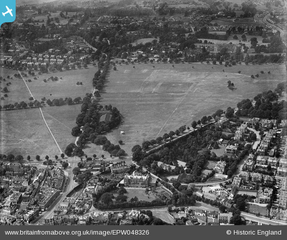
epw048326 ENGLAND (1935). Durdham Down and environs, Bristol, 1935
© Copyright OpenStreetMap contributors and licensed by the OpenStreetMap Foundation. 2024. Cartography is licensed as CC BY-SA.
Details
| Title | [EPW048326] Durdham Down and environs, Bristol, 1935 |
| Reference | EPW048326 |
| Date | July-1935 |
| Link | |
| Place name | BRISTOL |
| Parish | |
| District | |
| Country | ENGLAND |
| Easting / Northing | 357160, 175098 |
| Longitude / Latitude | -2.6168716665956, 51.47273528138 |
| National Grid Reference | ST572751 |
Pins
 Louis |
Sunday 28th of September 2014 11:33:20 AM |


![[EPW048326] Durdham Down and environs, Bristol, 1935](http://britainfromabove.org.uk/sites/all/libraries/aerofilms-images/public/100x100/EPW/048/EPW048326.jpg)
![[EPW048328] Durdham Down and environs, Bristol, 1935](http://britainfromabove.org.uk/sites/all/libraries/aerofilms-images/public/100x100/EPW/048/EPW048328.jpg)
![[EPW048327] Durdham Down and environs, Bristol, 1935](http://britainfromabove.org.uk/sites/all/libraries/aerofilms-images/public/100x100/EPW/048/EPW048327.jpg)