
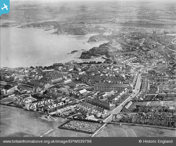
epw039798 ENGLAND (1932). Newquay Bay, Crantock Street and the town, Newquay, from the west, 1932
© Copyright OpenStreetMap contributors and licensed by the OpenStreetMap Foundation. 2024. Cartography is licensed as CC BY-SA.
Details
| Title | [EPW039798] Newquay Bay, Crantock Street and the town, Newquay, from the west, 1932 |
| Reference | EPW039798 |
| Date | August-1932 |
| Link | |
| Place name | NEWQUAY |
| Parish | NEWQUAY |
| District | |
| Country | ENGLAND |
| Easting / Northing | 180470, 61679 |
| Longitude / Latitude | -5.0903362050218, 50.4132883024 |
| National Grid Reference | SW805617 |
Pins
Be the first to add a comment to this image!
User Comment Contributions
I can see my house from up here! |
 Claire |
Sunday 10th of July 2016 11:40:53 PM |