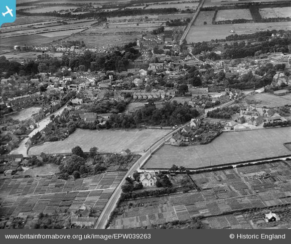
epw039263 ENGLAND (1932). The town, Thetford, from the north-east, 1932
© Copyright OpenStreetMap contributors and licensed by the OpenStreetMap Foundation. 2025. Cartography is licensed as CC BY-SA.
Details
| Title | [EPW039263] The town, Thetford, from the north-east, 1932 |
| Reference | EPW039263 |
| Date | July-1932 |
| Link | |
| Place name | THETFORD |
| Parish | THETFORD |
| District | |
| Country | ENGLAND |
| Easting / Northing | 587380, 283418 |
| Longitude / Latitude | 0.75563785144571, 52.416232856784 |
| National Grid Reference | TL874834 |
Pins

d.osborne |
Thursday 14th of May 2015 01:34:39 PM | |

d.osborne |
Thursday 14th of May 2015 01:32:09 PM | |

d.osborne |
Thursday 14th of May 2015 01:29:34 PM | |

d.osborne |
Thursday 14th of May 2015 01:27:33 PM | |

d.osborne |
Thursday 14th of May 2015 01:25:16 PM | |

d.osborne |
Thursday 14th of May 2015 01:23:41 PM | |

d.osborne |
Thursday 14th of May 2015 01:22:11 PM | |

d.osborne |
Thursday 14th of May 2015 01:20:25 PM | |

d.osborne |
Tuesday 5th of May 2015 03:35:32 PM | |

d.osborne |
Tuesday 5th of May 2015 03:32:15 PM | |

d.osborne |
Tuesday 5th of May 2015 03:30:42 PM | |

d.osborne |
Tuesday 5th of May 2015 03:29:16 PM | |

d.osborne |
Tuesday 5th of May 2015 03:26:31 PM | |

d.osborne |
Tuesday 5th of May 2015 03:23:04 PM | |

d.osborne |
Tuesday 5th of May 2015 03:21:20 PM | |

d.osborne |
Tuesday 5th of May 2015 03:19:58 PM | |

d.osborne |
Tuesday 5th of May 2015 03:18:20 PM | |

d.osborne |
Tuesday 5th of May 2015 03:16:28 PM | |

d.osborne |
Tuesday 5th of May 2015 03:14:22 PM | |

d.osborne |
Tuesday 5th of May 2015 03:13:12 PM | |

d.osborne |
Tuesday 5th of May 2015 03:11:47 PM | |

d.osborne |
Tuesday 5th of May 2015 03:09:21 PM | |

d.osborne |
Tuesday 5th of May 2015 03:08:12 PM | |

steve |
Friday 18th of July 2014 10:23:58 AM | |
The present Red Lion was built on this site in 1837 replacing an earlier inn that was purchased by the Corporation of Thetford early in the 17th century and probably stood where the War Memorial is today. |

d.osborne |
Saturday 18th of April 2015 10:13:20 PM |

steve |
Friday 18th of July 2014 10:22:24 AM | |
The earliest reference that I have found to the Black Horse is 1770. It was then occupied by Johnathan Newell, a local lime burner whose kilns were situated close by where Lime Kiln Lane is today. |

d.osborne |
Saturday 18th of April 2015 10:10:32 PM |

