
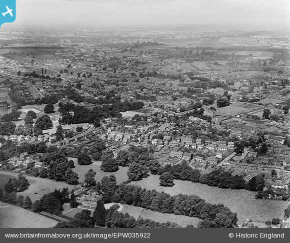
epw035922 ENGLAND (1931). Old Swinford and environs, Stourbridge, from the south-east, 1931
© Copyright OpenStreetMap contributors and licensed by the OpenStreetMap Foundation. 2026. Cartography is licensed as CC BY-SA.
Details
| Title | [EPW035922] Old Swinford and environs, Stourbridge, from the south-east, 1931 |
| Reference | EPW035922 |
| Date | July-1931 |
| Link | |
| Place name | STOURBRIDGE |
| Parish | |
| District | |
| Country | ENGLAND |
| Easting / Northing | 390326, 283165 |
| Longitude / Latitude | -2.1423491295133, 52.445989085286 |
| National Grid Reference | SO903832 |
Pins

tween |
Wednesday 12th of February 2014 10:14:41 AM | |
|
tween |
Wednesday 12th of February 2014 10:13:22 AM | |
|
tween |
Wednesday 12th of February 2014 10:12:04 AM | |
|
James Chandler |
Monday 27th of January 2014 09:27:15 PM | |
|
aajhiggs |
Thursday 26th of December 2013 10:16:04 PM |