
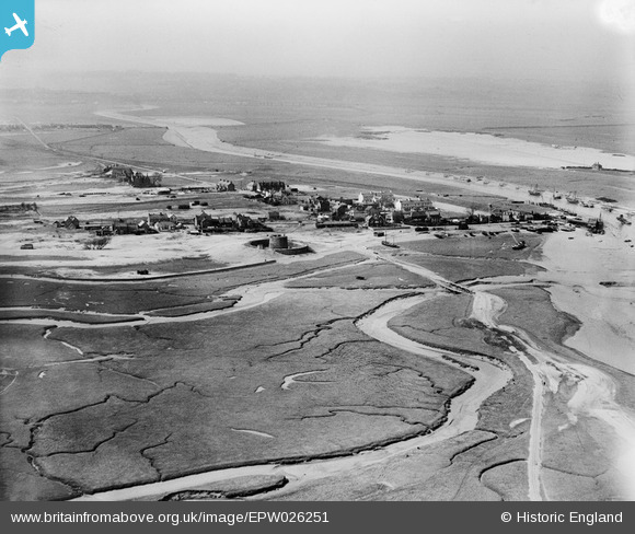
epw026251 ENGLAND (1929). Martello Tower 28 and the village, Rye Harbour, from the south-east, 1929
© Copyright OpenStreetMap contributors and licensed by the OpenStreetMap Foundation. 2025. Cartography is licensed as CC BY-SA.
Details
| Title | [EPW026251] Martello Tower 28 and the village, Rye Harbour, from the south-east, 1929 |
| Reference | EPW026251 |
| Date | 25-April-1929 |
| Link | |
| Place name | RYE HARBOUR |
| Parish | ICKLESHAM |
| District | |
| Country | ENGLAND |
| Easting / Northing | 594375, 118646 |
| Longitude / Latitude | 0.76663191260787, 50.933908384026 |
| National Grid Reference | TQ944186 |
Pins

cric |
Tuesday 20th of August 2013 02:14:49 PM | |
|
cric |
Tuesday 20th of August 2013 02:12:57 PM | |
|
cric |
Tuesday 20th of August 2013 02:12:13 PM | |
|
cric |
Tuesday 20th of August 2013 02:11:13 PM | |
|
cric |
Tuesday 20th of August 2013 02:09:55 PM |
User Comment Contributions
I was born in Rye Harbour in 1949 and I can still identify some of the buildings today. The Martello was named "Enchantress". The large double gabled house to the right of the Martello was the Vicarage (now a B&B)and my parents old house is the second block back from the vicarage. |
cric |
Tuesday 20th of August 2013 02:04:17 PM |