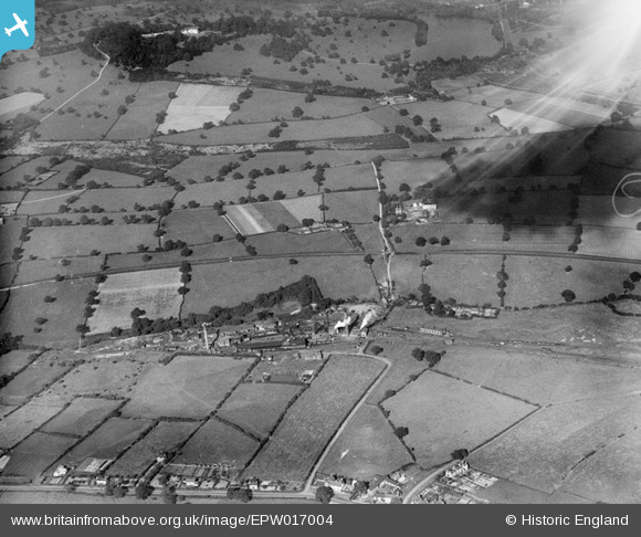
epw017004 ENGLAND (1926). West Hallam Colliery and Shipley Hall park, West Hallam, from the south, 1926
© Copyright OpenStreetMap contributors and licensed by the OpenStreetMap Foundation. 2024. Cartography is licensed as CC BY-SA.
Details
| Title | [EPW017004] West Hallam Colliery and Shipley Hall park, West Hallam, from the south, 1926 |
| Reference | EPW017004 |
| Date | October-1926 |
| Link | |
| Place name | WEST HALLAM |
| Parish | WEST HALLAM |
| District | |
| Country | ENGLAND |
| Easting / Northing | 444227, 342359 |
| Longitude / Latitude | -1.3412721902744, 52.976442665521 |
| National Grid Reference | SK442424 |
Pins
 MB |
Friday 5th of February 2021 04:56:46 PM | |
 MB |
Friday 5th of February 2021 04:56:19 PM | |
 Thall |
Sunday 25th of January 2015 07:45:39 PM | |
 Ilsonbloke |
Wednesday 13th of February 2013 01:31:58 PM |

