
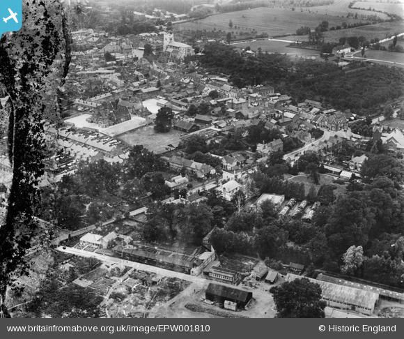
epw001810 ENGLAND (1920). View over Waltham Abbey from Sewardstone Road and Britannica Works, Waltham Abbey, 1920
© Copyright OpenStreetMap contributors and licensed by the OpenStreetMap Foundation. 2025. Cartography is licensed as CC BY-SA.
Details
| Title | [EPW001810] View over Waltham Abbey from Sewardstone Road and Britannica Works, Waltham Abbey, 1920 |
| Reference | EPW001810 |
| Date | June-1920 |
| Link | |
| Place name | WALTHAM ABBEY |
| Parish | WALTHAM ABBEY |
| District | |
| Country | ENGLAND |
| Easting / Northing | 538440, 200430 |
| Longitude / Latitude | 0.0028545045783069, 51.685077483761 |
| National Grid Reference | TL384004 |
Pins

tiv |
Sunday 13th of November 2022 11:56:13 AM | |
|
Ray Flack |
Wednesday 13th of November 2013 03:25:23 PM | |
|
Ray Flack |
Wednesday 13th of November 2013 02:34:22 PM | |
|
Ray Flack |
Wednesday 13th of November 2013 02:12:25 PM | |
|
Ray Flack |
Wednesday 13th of November 2013 02:09:04 PM | |
|
Ray Flack |
Wednesday 13th of November 2013 01:54:05 PM | |
|
Ray Flack |
Wednesday 13th of November 2013 01:51:49 PM | |
|
Ray Flack |
Wednesday 13th of November 2013 01:50:23 PM | |
|
Ray Flack |
Wednesday 13th of November 2013 01:47:58 PM | |
|
Ray Flack |
Wednesday 13th of November 2013 01:47:17 PM | |
|
Ray Flack |
Wednesday 13th of November 2013 01:46:20 PM | |
|
Ray Flack |
Wednesday 13th of November 2013 01:05:22 PM | |
|
Ray Flack |
Wednesday 13th of November 2013 01:04:27 PM | |

hillman34 |
Saturday 29th of June 2013 08:53:17 PM |